Education
Visit our Gallery and Activities & Documents pages to access classroom activities, data-driven tools, interactive quizzes, videos, images, podcasts, posters, and more. In addition, these resources have been organized around the following fundamental questions which address educational standards and national ocean literacy efforts:
- What role does salt play in the basic properties of water?
- How do water cycle processes relate to the ocean?
- What are the effects of temperature on seawater density and circulation?
- How does the ocean influence climate?
- How is the water cycle changing, and how are these changes affecting the ocean?
- How does density-driven circulation affect climate – and vice versa?
- How can technology and collaboration enhance understanding of the ocean?
Mapping Earth's Water Cycle
The Earth's water cycle – the movement of water around the globe – plays a large role in our understanding of global climate. Several
Earth-focused NASA missions are shedding new light on the processes within the water cycle; these findings are being used to
investigate natural phenomena such as storms, flooding, and drought. Explore water in our earth system using the online
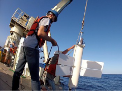
Earth Wheel activity, which showcases data from three NASA satellite missions: Aquarius
(which measured ocean salinity), GRACE (using gravity to understand water storage), and TRMM (measuring precipitation).On October 16th, two scientists from different NASA missions (Aquarius and GRACE) paired up to present a webinar featuring sea surface salinity measurements from Aquarius and water storage visualizations generated from GRACE gravity field data. View the archived webinar here.
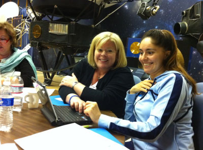
Highlighting Ocean Sciences & Engineering Practices
Recently, the EPO team deconstructed these webinars into smaller pieces for educators to use in their curriculum and to enhance classroom activities. In the Fall of 2014, this product, Highlighting Ocean Sciences & Engineering Practices, was accepted to the NASA Wavelength resource center. This product has been organized by topic, as well as by science and engineering practices, outlined by the Next Generation Science Standards (NGSS).
NASA Wavelength is a digital repository of Earth and space science resources for educators of all levels. All content on Wavelength has been peer-reviewed to ensure that the content is accurate for use in educational environments.
What's New in Aquarius Education
Interactive NASA Earth Wheel Activity
[14-Sep-15] Explore water in our earth system using this online version of the Earth Wheel activity, which showcases data from four current NASA missions. Aquarius Sea Surface Salinity, 2011-2015 (Flat Map)
[14-Sep-15] This visualization shows the complete observations of sea surface salinity taken during the life span (2011 through May 2015) of the Aquarius spacecraft. Sea surface salinity is shown ranging from 30 to 40 PSU (from blue to green to red) on a flat map using simple cartesian (rectangular) projection. The visualization was generated based on version 4.0 of the Aquarius data products. Aquarius Sea Surface Salinity, 2011-2015 (Mollweide)
[14-Sep-15] This visualization shows the complete observations of sea surface salinity taken during the life span (2011 through May 2015) of the Aquarius spacecraft. Sea surface salinity is shown ranging from 30 to 40 PSU (from blue to green to red) on a flat map using extended Molleide projection. The visualization was generated based on version 4.0 of the Aquarius data products.