Gallery
Aquarius Satellite Maps Ocean Salinity Structure
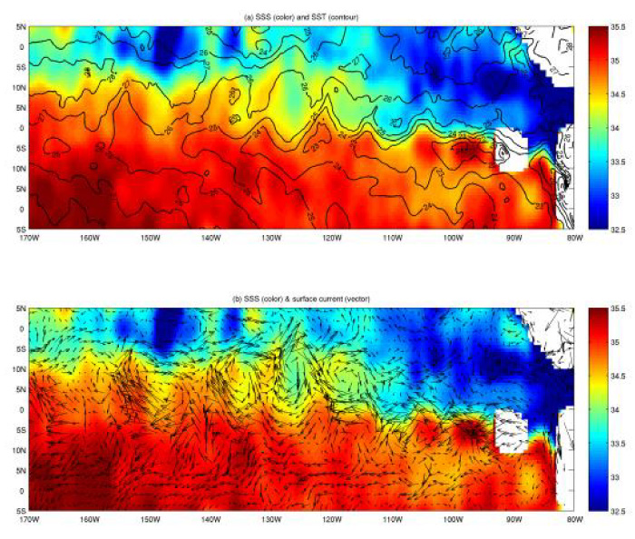
[12-Jun-12] Early results using salinity data from NASA's Aquarius instrument on the Aquarius/SAC-D observatory have given scientists an unprecedented look at a key factor involved in the formation of an oceanic wave feature in the tropical Pacific and Atlantic Oceans that influences global climate patterns. Original image: Photojournal. Credit: NASA/JPL-Caltech/GSFC.View: Click on the image to enlarge. Click on the Escape key or anywhere outside the shadowbox to close.
Download: To download a copy, right click on the image and select Save Image As (on a Mac keyboard, click the touchpad while holding down the Control key). To download the highest resolution in our database, first click on the image to enlarge and then save that version.