Science Webinars: NASA Engineers' Stories


Los ingenieros de la NASA comparten sus historias en un Webinar en Español
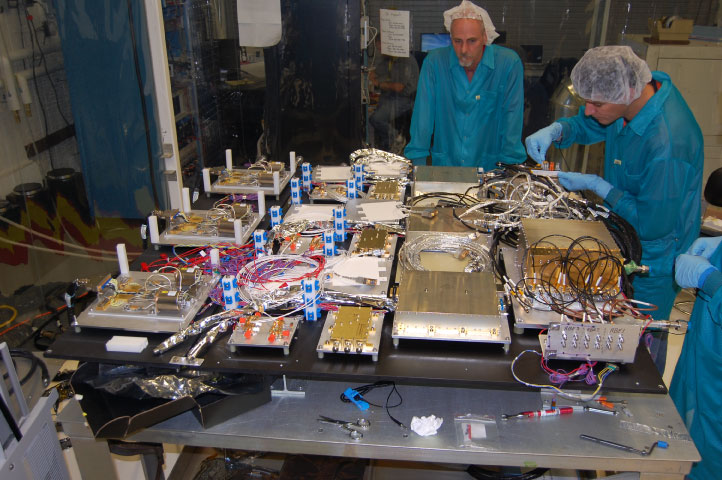
Por favor únase a ingenieros de Goddard Space Flight Center mientras discuten su trabajo en el Aquarius/SAC-D. La misión - una
colaboración entre la NASA y la CONAE, la Agencia Espacial de Argentina - fue lanzada el 10-jun-11 desde la costa de California
después de haber sido construido y probado en los EE.UU., Argentina y Brasil. El objetivo científico principal es recoger
datos sobre la salinidad de los océanos, la revelación de información relevante para la circulación oceánica, el ciclo
del agua y el clima.En este seminario web en español se escuchará a partir de tres ingenieros experimentados - Amri Hernández-Pellerano (Ingeniero Electricista en Sistemas de Potencia), Shannon Rodríguez (Ingeniero Electricista en Sistemas de Radio) y Fernando Pellerano (Ingeniero en Sistemas de Instrumentos).
NASA Engineers Share Their Stories in a Spanish-Language Webinar
Ever wonder what it's like to build and test instruments that operate in space? Hear it directly from the "heroes" behind
the scenes of a NASA mission!In this Spanish-language webinar, Goddard Space Flight Center engineers discuss their work on the Aquarius/SAC-D satellite. The mission - a collaboration between NASA and CONAE, the Space Agency of Argentina - launched on 10-Jun-11 from the coast of California after being built and tested in the U.S., Argentina and Brazil. The primary scientific aim is to collect data on the salinity of our oceans, revealing information relevant to ocean circulation, the water cycle and climate.
Webinar Video
In this webinar you will hear from three seasoned engineers - Amri Hernandez-Pellerano (Power System Electronics Designer),
Shannon Rodriguez (Microwave Communications Specialist) and Fernando Pellerano (Instrument System Engineer).Concept Map
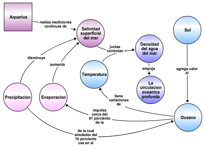
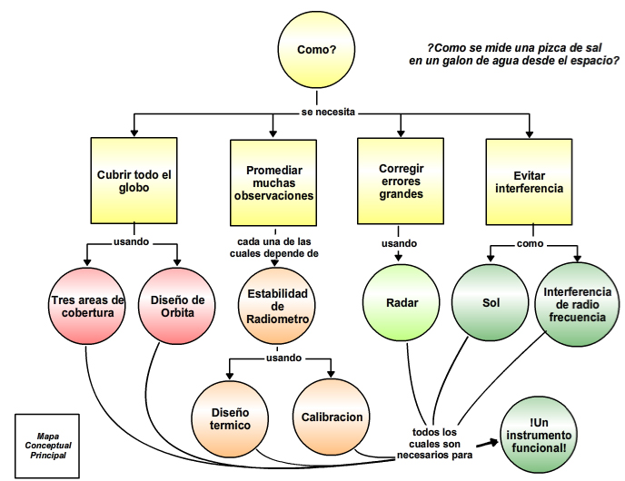
This webinar features several concept maps. Below is the concept map used to organize the presentation. Hover over the concepts
to access additional resources, or save this map to your CLIMB account
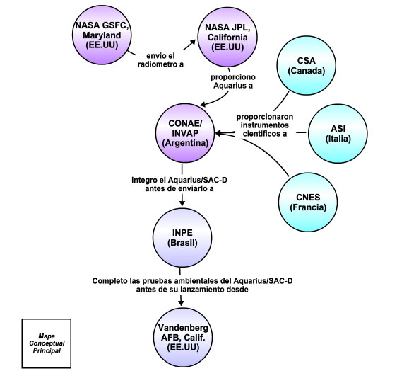
by clicking the blue wrench in the upper left corner and selecting Copy Map to My Maps.The three concept maps presented during the webinar are shown below (click on the images to view these maps in CLIMB). The first concept map presents the principles behind salinity in the ocean, the second explores how salinity is measured from space, and the third highlights the international collaborations that made the Aquarius/SAC-D mission happen.
| ¿Que es Salinidad? | ¿Como se mide la salinidad desde el espacio? | Colaboracion Internacional |
 |
 |
 |
Evaluation
A total of 113 participants attended this webinar, which aired on October 17, 2012. 74% were from Argentina, followed
by 12% from Colombia. Ten participants from six U.S. states and Puerto Rico, as well as one participant each from Greece,
Guatemala, Italy, Brazil and Canada also attended.Sixty two percent of the attendees identified as educators. Most of these teach a variety of subjects at the high school level (31), followed by middle school (16), college (8), and elementary school (6). Fifty one indicated they were currently teaching a course in a STEM (Science, Technology, Math and Engineering) discipline.
Resources
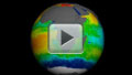
Aquarius Sea Surface Salinity Tour 2012
(00:03:17)
The Aquarius spacecraft was designed to measure global sea surface salinity. It is important to understand salinity, the amount
of dissolved salts in water, because it will lead us to a better understanding of the water cycle and can lead to improved
climate models. Aquarius is a collaboration between NASA and the Space Agency of Argentina.This visualization celebrates over a year of successful Aquarius observations. Sea surface salinity is shown at various locations around the globe highlighting the following:
- The Atlantic Ocean is generally much more salty than the Pacific
- Low salinity waters in the Eastern Equatorial Pacific are transported westward
- High influxes of fresh water from the Amazon River basin can be clearly seen low salinity waters are transported by the Labrador current to the south
- High influxes of fresh water from the Ganges River basin can be seen keeping the Eastern Indian Ocean lower salinity than the Western Indian Ocean
NASA's Aquarius Sees Salty Shifts
(Aquarius observa cambios en la salinidad de los océanos)
27-Feb-13 Media Release. Colorful images
chronicle the seasonal stirrings of our salty world: pulses of freshwater gush from the Amazon River's mouth; an invisible
seam divides the salty Arabian Sea from the fresher waters of the Bay of Bengal; a large patch of freshwater appears in
the eastern tropical Pacific in the winter. These and other changes in ocean salinity patterns are revealed by the first full
year of surface salinity data captured by NASA's Aquarius instrument. Click here
for the Spanish language version of this media release.Teaching Physical Concepts in Oceanography: An Inquiry Based Approach
(Enseñanza Práctica de Conceptos de Oceanografía Física: Una Aproximación Basada en Preguntas y Respuestas)
This supplement to Oceanography magazine focuses on
educational approaches to help engage students in learning and offers a collection of hands-on/minds-on activities for teaching
physical concepts that are fundamental in oceanography. Has been translated into
Spanish,
Catalan, and
French.